10 February 2022
Blog
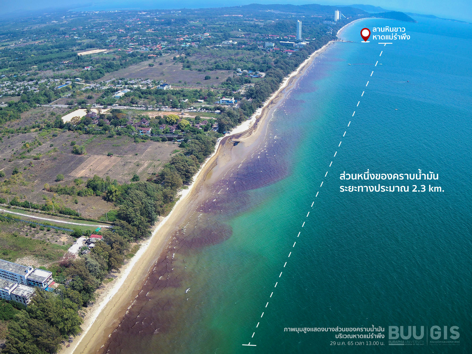
On January 29, 2022, Faculty of Geoinformatics Burapha University led a team of researchers from the Geospatial Innovation Center and SCGI students. Collect aerial image data from unmanned aerial vehicles (UAV) to create a detailed photographic map at a centimeter scale. which has a higher resolution than satellite images and because the ceiling is lower than the clouds This makes it possible to take good pictures even under cloudy conditions.

On today's mission, the Faculty, courtesy of Devdronemapper, led a small unmanned aerial vehicle equipped with a thermal camera. infared joins in supporting this mission as well. The thermal camera Infared stores the surface temperature of the object in the image. by the temperature of the beach area contaminated by oil stains will be one of the factors that will be included in the analysis to assess the size of the area damaged by oil stains this time From the flight of photographs taken from Mae Ramphueng Beach, around the white stone courtyard, to the east coast, it was found that some of the oil stains had been brought in by the waves and floated on the beach. It is about 2.3 kilometers long. At the moment, all staff are working hard to remove and suck the oil spill from the beaches in this area as quickly as possible. and has announced from the provincial governor Refrain from allowing tourists to play around the beach and the sea To reduce chemical contamination and to facilitate the staff to work on removing oil stains fully.
If there is progress or there is news about the oil spill situation, the Faculty will continue to update.